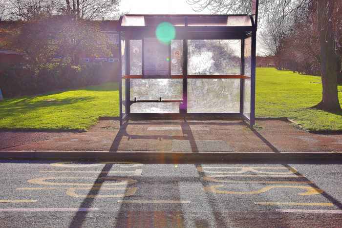
Image Credit: Adrian Scottow / CC BY-SA 2.0 / Flickr
More Guest Blogs


By JUNFENG JIAO and NICOLE McGRATH
As any commuter who has experienced unreliable service or lives miles away from a bus stop will tell you, sometimes public transit isn’t really a viable option, even in major cities.
In our car-loving society, where 85% of Americans use a car to get to work, people who cannot access transportation are excluded from their own communities and trapped inside “transit deserts.” This term, which one of us (Junfeng Jiao) coined, describes areas in a city where demand for transit is high but supply is low.
Lack of transit has harmful effects on those who rely on public transit — generally, people who are too young, too old, too poor, or have disabilities that don’t allow them to drive. Mapping these deserts will help agencies adjust transit services and better serve their communities.
At the University of Texas-Austin’s Urban Information Lab, our research focuses on refining the methods used to quantify and measure transit supply and demand. We’ve developed clear and concise geographic information system (GIS) methods to evaluate transportation systems, providing alternatives to previous, more complicated network modeling. These methods can quickly be applied to any location, as we have shown in studies of five major cities in Texas and other cities across the United States. By using this method, we found that hundreds of thousands of transit-dependent people in Texas don’t have access to mass transit systems.
Connecting people to jobs and services
Research shows that low-income residents living in sprawling areas have limited transportation options, which constrains their job opportunities and upward mobility. Inadequate transportation keeps people from finding work, which then reduces the productivity of their communities. It also can limit access to medical services, causing health problems to go undetected or worsen.
Addressing transit access is one important strategy for tackling broader social problems. For example, welfare recipients are less likely to own cars or have access to transit than the general population. Reducing these transportation barriers would help move them from welfare to work.
Although scholars have been studying “food deserts” (areas where residents lack access to nutritious food) for several decades, we have only recently applied this logic to mass transportation systems, despite the fact that food deserts often occur due to lack of transportation.
Relatively little research has been carried out to identify and quantify gaps between transit demand and supply. But as counties and cities feel the effects of declining funding from federal and state transportation user fees, they need new ways to target transportation infrastructure investments and ensure limited resources are used in the best way possible. We have found that maps are a promising way to guide these discussions.
Mapping transit deserts
Determining exactly who relies on mass transit can be difficult. Existing information depends on census data. As previously noted, people who rely on transit are usually from marginalized demographic groups. They may be elderly, poor, or have disabilities that keep them from driving. Census data do not account for the fact that sometimes these populations overlap (a transit-dependent person could be old as well as poor), so one individual could be counted many times.
Also, census data on car ownership are not available at the census block group level, which is the smallest geographic unit published by the U.S. Census Bureau. This lack of data makes it hard to measure transit dependency with accuracy.
Measuring transit supply is easier. It relies on data from municipal planning agencies as well as relevant municipal and county GIS departments, which manage spatial and geographic information, analysis tools, and mapping products. These agencies measure variables that include number of transit stops, transit routes, and frequency of service, as well as lengths of sidewalks, bicycle lanes, and low speed-limit routes (which are relevant because some commuters may opt to walk instead of taking the bus).
Beyond city centers
Current research shows that transit deserts exist all over the country. Cities such as Chicago; Cincinnati; Charlotte; North Carolina; Portland, Oregon; and San Antonio contain multiple communities that don’t have enough transit services to meet existing demand. Even in older cities, where development tends to follow transit lines, there are neighborhoods where the supply of transit is simply not enough.
This is a large-scale problem. In San Antonio, the seventh-largest U.S. city by population, some 334,530 people — nearly one-fourth of the population — need access to public transportation in a city that doesn’t even have rail service. In Chicago, where there are high levels of transit dependency all across the city, just three of the transit desert neighborhoods that we identified house approximately 176,806 residents. Even in a city as progressive as Portland, Oregon, thousands live in transit desert neighborhoods.
When it comes to geographic location, transit demand and supply appear to follow certain spatial patterns. Unsurprisingly, transit supply is highest in city centers and decreases as distance from city centers increases. As a result, transit deserts do not typically occur in city centers or near downtown. In fact, because of the typical “hub and spoke” design of many transit services, city centers often have transit surpluses where supply outstrips demand.
The location of transit deserts often does not follow a geographic pattern, although they are usually associated with low-income and remote areas. While planners and engineers may have a rough idea of where supply is low, making service adjustments requires measuring and mapping of transit supply and demand citywide.
Rebalancing transit networks
Many cities are now making service adjustments to improve service to transit deserts. For example, Houston’s transit authority, METRO, recently redesigned its bus service as part of a larger “Transit Service Reimagining,” in an attempt to better meet the region’s mobility needs. Evaluation of the new transit services shows that current levels of transit demand and supply are more balanced, though gaps still exist.
Identifying transit deserts is even catching on at the federal level. The U.S. Department of Transportation recently launched a new initiative to map transit deserts nationally through a National Transit Map, which will put together data from different transit agencies into a complete feed. By accessing a larger, national look at transit demand and supply, regional agencies will have extra tools available to them when making changes to their local transit services.
What these changes will be is hard to say. Expanding existing bus services may be the most cost-effective way to improve transit access. Even in New York City, with its massive subway system, city officials are increasingly turning to bus rapid transit due to the high cost of adding new subway lines.
Adding bus lines, increasing service hours, and even streamlining boarding and fares can help improve service and increase access. Integrating bicycling with transit services would be another cost-effective option.
As research on transit deserts continues to grow, more precise methods of quantifying the gap between transit supply and demand should develop. More research may provide new views on how the built environment and socioeconomic variables affect transportation accessibility. With careful planning and investment, these transit deserts can eventually transform into transit oases.
Junfeng Jiao is an assistant professor of community and regional planning and director of the Urban Information Lab at the University of Texas at Austin. Nicole McGrath is a master’s degree candidate in community and regional planning at UT at Austin. This post originally appeared at The Conversation.
Weekly Newsletter
Get building science and energy efficiency advice, plus special offers, in your inbox.


One Comment
An amusing back story
There is an amusing back story where there is one particular use of a transit bus station that is used in exactly the opposite purpose of the very valid idea behind this post. I think I heard this on an NPR program about nursing homes. There is a problem where nursing homes struggle with how to handle some patients that were physically mobile but had a very specific kind of dementia condition. There are numerous kinds of dementia and how people can act out in that condition. Many of these specific dementia patients would want to leave the facilities and would become very upset when they were restrained from leaving. A very specific solution was found for many of these patients. They placed bus transit benches very close to the nursing facility. These were transit benches that were not served by any municipal buses. The patients were then allowed to leave the facility and would reliably go to the bench and sit down and wait for the bus, which would never come. Eventually they forgot why they came out there and would go back into the facility. I kid you not.
This side story was not to make light of this post. I agree completely with its idea of better serving city and towns transportation needs through increased transit systems, especially for low income residents.
Log in or create an account to post a comment.
Sign up Log in