Another Climate Zone question
I’ve done some searching around the site and the web and cannot find the info I am looking for.
I will be building a home in Jefferson (Jeffco) County Colorado, which is listed as a 5B zone. My problem with this is that Jeffco has such a large elevation range. The lowest elevation is 4,987 ft and the high is 9,127 ft. The weather and temperature in the county can vary by a lot, like it could be snowing in one place and 75 degrees in another at the same time (you have to know Colorado, this can and does happen all the time). Jeffco covers open plains up to rugged mountains.
I have tried basing it on the zip code, but my zip code covers such a large area, that the elevation difference in just the zip code can change by 3,300 ft.
I’ve thought about using the next county over, Park County, but that jumps to zone 7B. The climate zone maps are crazy in Colorado. How can you go from a zone of 5B to 7B just based on a line on a map?!
I’ve also learned that the zones are based on heating degree days.
Here is how it is calculated:
Heating Degree DaysThe degree-day measurement is the difference in temperature between the mean (average) outdoor temperature over a 24-hour period and a given base temperature for a building space, typically 65°F
The home I want to build will be at the upper end of the elevation, 8,400 ft. I’ve tried looking for temperature data, but there isn’t a weather station close to my area and I wouldn’t know how to get the info from it if I could.
So how would one go about finding out what climate zone I should build to? I understand that I could just go to zone 6B can call it good, but I am a data guy and don’t like to just go larger to be safe. This is also important to me because I want to use exterior insulation and need to know how what percentage of R value I need on the exterior of the building for both the roof and walls. Zone 5 is 30%, while zone 6 is 35%. This will also affect my Manual JSTD’s. This can and will drive the amount and location of the insulation, double or triple windows, and the size of the heating/cooling equipment. So there is a real cost difference depending on where I end up.
Thanks for any help.
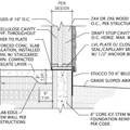
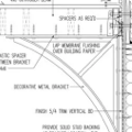
GBA Detail Library
A collection of one thousand construction details organized by climate and house part


Replies
I have family in Colorado (near Parker), so I'm familiar with the crazy weather out there :-)
Most of the variation you'll see in climate zones in the Colorado area is probably going to mainly due to elevation changes. The climate zone maps aren't usually super high-resolution, and I'm not aware of any that are, so they aren't particularly good for showing where you should be when you're in an area of rapid elevation changes -- the maps just don't have enough detail.
What I would do is find a nearby area with an unambiguous climate zone listed and of the SAME elevation as your building site, then use that climate zone for your design. You won't have any problems building to a higher climate zone number except for added cost in your region, so if you're OK erring a bit towards a higher climate zone number than needed, you'll spend a bit more but you'll also have a bit better performing home.
Bill
Bill, thanks for the comments. I am looking now for historic data. I cannot find any current, so I am not looking for personal weather stations.
Thank you for the advice.
Joe,
Like Zephyr says, but try to find the most exact parallel location for terrain, sun and wind exposure. As you note it can be crazy variable. Also, be advised that the local building code might set the minimum design temperature for figuring heating capacity. This can be very problematic with the large elevation range in the county.
Our county goes from 6ooo to 10,000 for building purposes. (Above that you have to be a bit nuts.) I was successful in getting the local building people to let me design for a less onerous minimum, for which I am grateful. If I had to meet the 10,000' zone requirement, I would have needed much more heating capacity than would ever be needed.
Some areas over by you are forcing oversized windows to be hurricane wind level rated. The top winds we have seen are around 40-45 so far, but be sure to check your area. Maybe you can find someone with a mini weather station. Anyway, best to ask what the code people want before you go in for big view windows. Another constraint you may face are wildfire/urban interface rules. Still lots of variation in those rules, so local info is your guide.
I'm at 8,000 on a plateau and locally I seem to be running a weak 6B for degree days. The locals call our part of the plateau "the banana belt". The nearest town is only 10 miles or so, but sits below the escarpment in a basin with mountains on three sides. They seem to run 10 to 15 degrees colder despite being nearly 1600 ft lower. The next town further suffers from being in a cleft between mountains. The sunshine available there is shorter due to shadowing. The effective cold in winter is still worse.
I built based on weather records a kind neighbor provided going back nearly 20 years from current date. The ugly average temperature trend has been upward though, with the beetle kill getting worse all the time as a result. I have outsulation like your planning, mine is close to 50% of overall on the outside. Whole wall is R-36, the batts R-19. For windows, I went with Alpen to get triple glazing and comfort. They have also proven very good at keeping wind and sound out.
I urge you to be very certain about the gas fill you get with whatever window you choose. Six years ago I found some major names would not ship windows with argon over 5,000 feet, which left me wondering about all of Denver. The sales people claimed air was just as good, so I moved on from them. I have heard some of the bigger players are claiming argon for high elevation installations now, but I would want that in writing.
Also think about low SHGC windows if you have lots of sun exposure. I was considered a bit contrarian for doing this on all our windows. The general gist being, why give up the free heat. The net gains for our orientation were even more minimal than full southern exposure, which were actually quite small anyway. Come summer you will be happier for keeping the very intense sun load out.
One other thing to note about being above data levels on the insulation is that keeping the house cool in the summer sun is just as valuable as keeping it warm. We skipped AC entirely based on the 30-40 degree temperature swings each day. We open up and vent out the house all night and then shut down before breakfast. So far it is quite workable given the level of insulation and having used 5/8 drywall through out to buffer the heat gain. Time will tell if the upward trend will force us to reconsider. Like they say, "it's dry heat, you don't notice".
All decisions are personal choices, but if you haven't lived up high before it is best to talk to people near where you intend to build. We were very fortunate to have three weeks to gain real life experience while tending cows for a friend. It was a very informative experience.
I have read the stories about the windows too. I will be looking into that too. I know Milgard has a plant just off of I-70 and Tower. I am interested in their fiberglass ones.
As for the hurricane comment, we will be in the only fire zone in Jeffco. That means a few things for us. We have to meet the CSU fire mitigation plan. The short version of it is that we cannot have a tree within 100ft of our house, trees from 100 to 150 ft out must be spaced out 10ft from the furthest point out and all branches must be cut off up to 10ft from the ground. We also have to remove all ground fuel. If you would like more info on it, here is what we have to follow.
https://csfs.colostate.edu/wildfire-mitigation/wildfire-defensible-space-checklist/
The second part of it is that all our windows must be tempered.
I don't think we will really need ac either, but I am putting in three mini-splits, so we will have it available either way. If you are wondering why 3, it is because they run more efficiently than the multi-zoned ones. I understand the costs, but because I am installing them, it is only a cost of my time and each unit.
Thanks for the input.
You could do adjustments (to HDD and design temp) with the adiabatic lapse rate (about 5.38 °F per 1,000 ft). But I like the idea of logging some data at your site (even a weeks worth) and comparing to the weather station at the same times.
When it comes to exterior foam, somewhat more is safer. Don't optimize to the thinnest possible, code minimum thickness.
I am basing the exterior insulation on Building Science Hybrid design, so it will not be a code minimum.
https://www.buildingscience.com/documents/building-science-insights/bsi-100-hybrid-assemblies
Jon R,
Logging very local data is really the only answer for these mountainous sites. I was very fortunate that the data I used was collected less than a mile and a half from our property. The varied effects from the surrounding mountains are quite astounding at times. A friends ranch is only 3 miles north of us but his precipitation patterns are totally different. My suspicion is that prevailing winds blowing across the nearest mountain create vortex swirls that push rain and snow away from his location. We can get 8" of snow on our site when he gets a dusting.
Virgas or rain bands are a common sight here. They look like floating patches of dark hair strands traveling across the sky. It is very common to be completely dry in one place only to drive into a wet band then out again. Tree specie populations reflect the water patterns more than the elevation.
It would be nice if a standard adjustment could be applied, but the variation seen between identical elevations works against that approach. As for being a bit overboard on the foam, the original design called for a different cladding that priced out of range. The final choice resulted in an additional layer being added. Hasn't hurt performance and being 100% electric heating I may be shaving demand to my advantage.
There are several high resolution, gridded climate products available. All gridded products have errors, but evaluations generally show they are surprisingly good in most places, even with the complex dynamics of mountain weather.
My usual GoTo for calculating e.g. HDD is Daymet, which is ~ 800m, and free. You can download from https://daymet.ornl.gov/
Daymet is free; PRISM has a circa 800 m product, but the daily data is propriety and expensive.
For additional data, see: https://www.ncdc.noaa.gov/
It's possible to analyze these in Excel, but easier in R or a language of your choice.
johng
Thank you for the website. The ncdc.noaa.gov/ site got me to within a few miles of our property.
This is what I came up with. One note to my numbers, I filled in the rest of 2020 with data from 2019.
HDD CDD
2011 7014 398
2012 6188.5 522.5
2013 7297 415.5
2014 6856 223.5
2015 6518.5 265.5
2016 6443 339.5
2017 6263.5 281.5
2018 6727 379.5
2019 7361 429.5
2020 6699.5 441
--------------------------------
Average 6740.9 361.7
Zone
5 5401 - 7200
6 7201 - 9000
7 9001 - 12600
It pretty clear that it is a zone 5 area. This makes me feel much better with data on my side.
I'm not going to lie, I will be creating a bell curve to see if 2019 is an outliner. But I am also a nerd.
Thanks to everyone for your comments.
Enough of those years are showing you right near the upper edge of CZ5. It might well be worth building as if you were in CZ6 just for a bit more energy efficiency. It is FAR more economical to put in extra insulation during a new build than it is to add it as a retrofit later.
If this were my home, I'd look into thicker than normal exterior rigid foam since I'm partial to building that way, but it's certainly not the only way to do it. I would not build to CZ5 minimum insulation levels in an area so near the upper limit of the range as yours (admittedly I never put in code minimum insulation though :-)
Bill
Hi Bill,
I agree about doing it now, rather than later.
Going through how I will insulate my house, I won't have to worry about it. I will have Zip R 2.5 on the outside (R-value of 12.5) and 5.5 inches of mineral wool in the stud bays (R-value of 22.5). This meets both the CZ5 and 6 requirements of the percentage of insulation required on the exterior, 30 and 35% respectively.